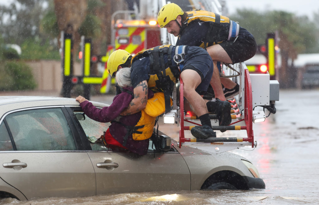
Scientists and meteorologists reported on Monday, November 2, 2026, that an extreme El Niño event is intensifying heavy rainfall and flash flooding across the Southwestern United States. The natural warming cycle, which involves the heating of Pacific Ocean waters, is releasing moisture into the atmosphere that serves as fuel for passing storms. While experts noted that El Niño is not the sole cause of recent weather, they stated it makes heavy precipitation more likely and intense.
The current weather patterns follow a period of significant rainfall in the region. According to calculations by Ryan Maue, a former chief scientist for the National Oceanic and Atmospheric Administration (NOAA), more than 20 trillion gallons of water have fallen across Nevada and the Four Corners states—Arizona, Colorado, New Mexico, and Utah—over the past two weeks. Experts characterized this specific iteration as more intense than typical cycles, with meteorologist Jeff Masters of Yale Climate Connections describing it as a "super duper El Niño."
Recent storms resulted in specific emergency actions and warnings across several states. On Sunday, November 1, flash floods triggered evacuations in central Arizona and northern New Mexico. In Colorado, authorities in a ski town issued warnings for a main river expected to reach catastrophic levels. Climate scientist Daniel Swain of the University of California Agriculture and Natural Resources noted that while increased precipitation is common for the Southwest this time of year, the current volume is occurring at a degree not previously observed.
The knock-on effects extend to regional water management and global weather stability. Locally, the rainfall may help fill reservoirs in the drought-prone Southwest, but the immediate threat to life and property requires significant emergency response resources. Globally, this El Niño is linked to record-breaking floods in Peru and Ecuador, while causing drier-than-normal conditions in Southeast Asian nations like Indonesia. The phenomenon sets a precedent for how natural cycles may interact with long-term increases in ocean temperatures, which meteorologist Randy Cerveny stated makes these situations more intense than those recorded 100 years ago.
The weather pattern is expected to continue for several months. Experts project the El Niño event will reach its peak in December 2026, at which point it may more strongly influence jet streams—strong air currents in the atmosphere—to produce additional extreme storms. Park Williams of UC San Diego's Scripps Institution of Oceanography stated that conditions are favorable for heavy storms to continue through the winter and spring of 2027. Local authorities have advised residents to monitor forecasts and adhere to all future evacuation warnings as the peak heating period approaches.