The Plain Record

Neutral daily news — clear headlines, complete facts.

Weather

Flood Watches Issued Across Multiple Regions as Heavy Rain Moves Across U.S.

The National Weather Service issued flood watches for several U.S. regions as a super El Niño pattern brings heavy rain to two dozen states through next week.

Published September 18, 2026 at 5:10 PM EDT

The short answer

The National Weather Service issued flood watches for several U.S. regions as a super El Niño pattern brings heavy rain to two dozen states through next week.

Flood Watches Issued Across Multiple Regions as Heavy Rain Moves Across U.S.

The Facts

Who
National Weather Service meteorologists, residents of affected states, and victims of recent floods on the Navajo Nation.
What
National Weather Service issued flood watches and warnings for multiple U.S. regions due to heavy rain and a super El Niño climate pattern.
When
Friday, September 18, 2026, through the following week
Where
Across approximately two dozen U.S. states, including the Southwest, Midwest, and East Coast.
Why
An intensifying super El Niño is loading the atmosphere with moisture, causing heavy rain that poses flash flooding risks, particularly in wildfire-affected areas and the southern U.S.

The National Weather Service issued flood watches for the Southwest, Intermountain West, and Midwest regions on Friday, September 18, as a period of heavy rain began moving across the country. Forecasters expect the rainfall to continue through the weekend and into the following week, potentially affecting residents in approximately two dozen states. The weather pattern is driven by an intensifying super El Niño, which has increased moisture in the atmosphere due to record-warm Pacific waters.

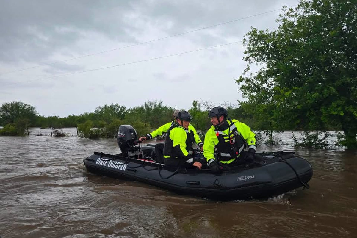
This storm system follows several fatal flooding events in the region. On Wednesday, September 16, three people, including a child, died after being swept away by floodwaters on the Navajo Nation. Previously, three individuals died during August flash floods at Grand Canyon National Park in Arizona, and flash floods in July required water rescues in Texas. Meteorologists noted that climate change and the current El Niño cycle are contributing to more frequent storms and elevated risks for severe weather.

On Friday, September 18, heavy rain was forecast for burn scars in Idaho and Montana, where scorched earth lacks the capacity to absorb water. The National Weather Service identified a "Slight Risk" of flash flooding for parts of Montana, the Dakotas, Minnesota, and Iowa. By Saturday, September 19, the threat is expected to shift east toward the Great Lakes, with downpours possible from Nebraska to Michigan. Additionally, the Boulder, Colorado, area is projected to see increased storm coverage and intensity on Saturday following scattered thunderstorms on Friday.

While the source did not provide a specific dollar amount for projected damages, the scale of the impact is reflected in the multi-state flood watches and the involvement of the National Weather Service across several regional offices. Residents will likely notice changes in their daily commutes and outdoor activities as the weather shifts from warm and dry to "unsettled" conditions. In cities like Boston, New York, Washington, D.C., and Raleigh, individuals may experience rain and thunderstorms through Monday, September 21, affecting local travel and public safety.

The knock-on effects of this moisture surge could influence future emergency management policies in wildfire-prone states like New Mexico and California, where flooding has worsened in recent years. As winter nears, forecasters expect these storms to become more frequent, particularly across the southern tier of states. Following the current storm, meteorologists are monitoring a separate system in western Mexico that may bring additional moisture to the Four Corners region next week. The National Weather Service in Wakefield, Virginia, indicated that rain chances will return for the Mid-Atlantic by late Sunday, September 20, or Monday, September 21.

Timeline of what happened

Key dates and decisions, in the order they occurred.

  1. July 2026

    Flash floods force water rescues in Texas

  2. August 2026

    Three people die in flash floods at Grand Canyon National Park

  3. September 16, 2026

    Three people killed in Navajo Nation floodwaters

  4. September 18, 2026

    Flood watches issued for Southwest, Intermountain West, and Midwest

  5. September 19, 2026

    Flooding threat expected to shift toward Great Lakes states

Summaries are written by The Plain Record to state the facts of a story plainly and without political slant. Drafted with AI assistance and checked against the source record before publication. See how we report, or report a correction.

← Back to the front page

Questions readers ask

What happened: Flood Watches Issued Across Multiple Regions as Heavy Rain Moves Across U.S?

National Weather Service issued flood watches and warnings for multiple U.S. regions due to heavy rain and a super El Niño climate pattern.

Who is involved?

National Weather Service meteorologists, residents of affected states, and victims of recent floods on the Navajo Nation.

When did this happen?

Friday, September 18, 2026, through the following week

Where did this happen?

Across approximately two dozen U.S. states, including the Southwest, Midwest, and East Coast.

Why does this matter?

An intensifying super El Niño is loading the atmosphere with moisture, causing heavy rain that poses flash flooding risks, particularly in wildfire-affected areas and the southern U.S.