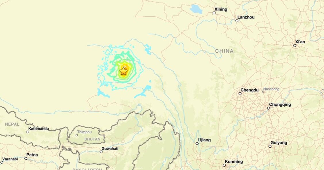
A magnitude 7.1 earthquake struck the Tibet Autonomous Region in southwestern China on January 7, 2025, resulting in at least 126 fatalities. The United States Geological Survey (USGS) reported the earthquake occurred at 9:05 a.m. local time with an epicenter in Tingri County, approximately 50 miles northeast of Mount Everest. The shock originated at a depth of 10 kilometers (6.2 miles) within the continental crust of the Tibetan Plateau.
The region had previously experienced environmental challenges, including flash flooding caused by a glacier collapse in 2024. Seismologists noted that the January 2025 event was caused by normal faulting along the Deng Me Cuo Fault. The China Earthquake Administration reported the entire rupture lasted 24 seconds and was felt across South Asia, including Nepal and northern India.
Casualty figures vary between official and local reports. The Chinese government confirmed 126 deaths and 351 injuries, while Tibetan sources reported between 134 and 400 fatalities. In neighboring Nepal, 13 people were injured. The quake damaged or destroyed homes in Tingri County and caused minor damage in northern India. Satellite analysis from the European Space Agency showed evidence of ground subsidence and uplift along a surface rupture extending 25 to 32 kilometers.
The scale of the disaster required significant rescue operations overseen by Chinese authorities. Beyond the immediate loss of life, the earthquake impacted the regional infrastructure of southwestern China, Nepal, and northern India. For households in the affected high-altitude areas, the event disrupted day-to-day stability in a region already prone to seismic activity and extreme weather events. The USGS ShakeMap indicated significant ground motion around the epicenter, which typically results in the displacement of families whose homes were rendered uninhabitable.
What happens next: In the aftermath of the January 7, 2025, mainshock, 3,614 aftershocks were recorded, the strongest of which reached a magnitude of 5.5. These secondary tremors continue to pose risks to damaged buildings and ongoing rescue efforts. The Chinese government and the Ministry of Natural Resources are using seismic inversion and remote sensing to map the full extent of the rupture to assess future geological stability. No specific deadline for the completion of reconstruction has been reported.